|
|
|
|
Stratigraphic coordinates, a coordinate system tailored to seismic interpretation |
In order to define the first step for transformation to stratigraphic coordinates, we follow the predictive-painting algorithm (Fomel, 2010), which is reviewed in appendix A. Predictive painting spreads the time values along a reference trace into the seismic volume to output the relative geologic age attribute
![]() . The painted horizons output by predictive painting are used as the first axis of our stratigraphic coordinate system. Several alternative methods exist to track horizons automatically in a seismic volume and produce horizon cubes (Hoyes and Cheret, 2011; Wolak et al., 2013). We choose predictive painting because of its simplicity and efficiency.
. The painted horizons output by predictive painting are used as the first axis of our stratigraphic coordinate system. Several alternative methods exist to track horizons automatically in a seismic volume and produce horizon cubes (Hoyes and Cheret, 2011; Wolak et al., 2013). We choose predictive painting because of its simplicity and efficiency.
In the next step, we find the two other axes,
![]() and
and
![]() , orthogonal to the first axis,
, orthogonal to the first axis,
![]() , by numerically solving the following gradient equations:
, by numerically solving the following gradient equations:
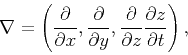
The stratigraphic coordinates are originally designed for depth images. When applied to time-domain images, the definition of the gradient operator becomes
|
|
|
|
Stratigraphic coordinates, a coordinate system tailored to seismic interpretation |